FarOut
- 4.5
- Rating
- 100.00K
- Installs
- Free
- Price

 Analysis by App-foxy
Planning a long walk, bikepacking trip, paddling route, or rafting day often starts with a messy collection of notes, screenshots, and map searches. I tried FarOut with that problem in mind, and its main appeal became clear quickly: it is designed to put outdoor route information into one navigation-focused place rather than making me assemble everything from general-purpose map apps. Developed by FarOut, this free Maps & Navigation app is aimed at people who need more than a blue dot on a road.
My overall impression is positive, especially for route-based adventures where preparation matters as much as movement. The app has an average rating of 4.5 from around 3,200 ratings, and more than 100,000 people have installed it. Those figures do not make it automatically right for everyone, but they do fit my experience: FarOut feels more useful once a trip has a defined route and a specific outdoor purpose.
From a vague trip idea to a usable outdoor plan
My starting condition was familiar. I knew the kind of outing I wanted, but I did not want to depend entirely on a standard road map. A normal navigation app is excellent for driving to a trailhead or finding a shop in town, yet it can become awkward when the important question is what happens along a long-distance trail, a bikepacking corridor, or a paddling route. FarOut approaches the problem from the route itself.
You May Also Like

 Blood Strike: 2.5 Anniversary
Blood Strike’s Loadouts Turn Every Drop Into a Tactical Gamble
A close look at Blood Strike’s custom loadouts: how fast access to signature weapons reshapes its battle royale rhythm, rewards preparation, and narrows the gap between fights.

 Pandora - Music & Podcasts
Pandora’s Music Is Easy to Start, but Harder to Recover
Pandora’s strength is its low-effort path from a seed to a station. Its weak spot is how much confidence it asks you to place in connection, setup, and quiet recovery.

 8 Ball Pool
 Is Built on Rivalries, Rematches, and Routine
A close look at the rivalries, rematches, shared routines, and unanswered safety questions that turn a quick pool match into a persistent mobile community.

 Samsung Music
’s Quiet Strength Is Playing What You Already Own
Its reach comes less from spectacle than from dependable access to a personal library. That simplicity is both the app’s strongest retention engine and its ceiling.

 AccuWeather: Weather Radar
AccuWeather Review: A Quick, Clear Forecast for Everyday Decisions
For everyday plans, the best forecast is the one you can understand quickly. AccuWeather makes rain timing, radar, and local conditions easy to act on, with a few trade-offs.

 Hill Climb Racing
Why Hill Climb Racing Still Turns Crashes Into One More Run
A tiny car, a bumpy hill and one more upgrade: Hill Climb Racing keeps resurfacing because its simple chaos makes every near-miss feel personal.
More From Our News Desk



The first useful habit is to decide what I need from the app before leaving home. If I am simply walking around a city, FarOut is unnecessary. If I am following a recognized outdoor route and want route context during the day, it makes much more sense. That distinction saves time and prevents disappointment. This is not an all-purpose replacement for every map on my phone; it is a more focused tool for outdoor navigation.
The app is free to install and is rated for Everyone, which makes it easy to try without committing money at the start. Its current version is 15.7.4 and it works on Android 8.0 or later. In-app purchases range from $0.99 to $96.00 per item, so the sensible approach is to explore the free experience first and only pay when a particular trip justifies it.
I also found it helpful to separate planning from navigation. At home, I can think about the whole outing: where I will begin, how far I expect to travel, where the difficult sections might be, and what information I need to check before setting off. On the route, I want fewer decisions. A navigation app is most valuable when it reduces uncertainty at the moment I am tired, distracted, or dealing with poor conditions.
Building the route before the trip
My next step was to use FarOut as a route-planning reference rather than immediately treating it like a turn-by-turn driving tool. I looked at the route in the context of my intended activity and considered what would matter during the day. For a hiker, that may mean understanding the sequence of a long trail. For a cyclist, it may mean keeping the route visible while managing distance and energy. For a paddler or rafter, the route needs to be considered alongside water conditions and personal skill.
That last point is important. A map can show where I am without telling me whether I am prepared for the conditions ahead. I would never use FarOut as a substitute for checking weather, water levels, local closures, daylight, or emergency planning. Its role is to support route awareness, not to remove the need for outdoor judgement.
A practical workflow is to review the intended route while I still have a reliable connection, decide what information I may need away from home, and then test the setup before the trip. I prefer to open the route, move around it, and confirm that the screens make sense before I am standing at a trail junction. That small rehearsal is one of the most useful habits with any navigation app, but it matters especially when the trip depends on a particular route rather than a nearby street.
I also avoid planning the day around a single perfect assumption. If I expect to cover a certain section, I think about what happens if I start late, move slowly, or need to stop early. FarOut helps me keep the route in view, but the decision about whether to continue remains mine. The app is strongest when it gives me context for a decision, not when I ask it to make the decision for me.
How I use it while moving
Once I am outside, the workflow becomes simpler. I use the map to confirm that my position matches the route I intended to follow, then return my attention to the surroundings. I do not stare at the screen continuously. A quick check at a junction, after a confusing bend, or when the landscape no longer matches my expectation is usually more useful than constant monitoring.
This is where FarOut feels different from a general map application. The purpose is not to guide me through every ordinary turn of a commute. It is to help me maintain awareness of a longer outdoor line. That makes it a better fit for a person who wants route continuity and a clearer sense of progress than for someone who only needs directions to a restaurant or parking area.
On a bikepacking day, I would use it in short checks: before leaving a rest stop, when approaching a route change, and whenever I need to confirm that I have not drifted away from the planned line. Stopping before checking the phone is safer than trying to read while riding. On foot, the same principle applies. The map should support observation, not compete with it.
For paddling and rafting, the trade-off is even sharper. Water movement, obstacles, changing weather, and group communication deserve priority over the screen. I would treat FarOut as one part of the navigation setup and keep a backup plan. A phone can become difficult to use when wet, cold, or low on power, so I would protect it and avoid assuming that an app alone is an adequate safety system.
The handoffs between phone, people, and preparation
A successful outdoor navigation workflow rarely stays inside one app. Before departure, I may use FarOut to understand the route, then use other sources to check transport, weather, local rules, or accommodation. That handoff is not a weakness unique to this app; it is simply the reality of planning an outdoor trip. FarOut is most useful as the route-centered part of that chain.
I also think about the handoff between the person holding the phone and everyone else in the group. If I am traveling with friends, I do not want the route to exist only on my screen. We should agree on the intended direction, meeting points, and what to do if someone falls behind or the group separates. The app can help me make those conversations more concrete, but it does not replace them.
For a solo outing, the handoff is between preparation and emergency readiness. I would tell someone where I am going, when I expect to return, and what alternatives I have if the route becomes unsuitable. FarOut can make the route easier for me to understand, but a trusted contact still needs a plain-language plan. That is a useful distinction for anyone tempted to treat digital navigation as a complete safety solution.
Another handoff happens when I switch from planning at home to navigating outdoors. The screen that looks obvious on a large, calm desk setup may feel less convenient in bright light, rain, gloves, or fatigue. I recommend deciding in advance what I will actually check during the trip. If I know which route information matters, I spend less time searching and more time moving safely.
What the experience delivers at the end of the day
The result I get from FarOut is not simply a line on a map. It is a more organized understanding of the route. I can begin with a broad idea, examine it before leaving, and use the app as a reference while progressing through the outing. That continuity is the app’s clearest strength.
It is particularly appealing to hikers who regularly follow long routes, cyclists who want a dedicated outdoor navigation reference, and paddlers or rafters who prefer to prepare around a mapped course. The app’s focus also makes it less distracting than trying to force a general-purpose map into an activity it was not designed to describe well.
I can imagine a realistic everyday scenario where this matters. Suppose I am leaving early for a weekend bikepacking ride. The night before, I review the planned route, consider where I may need to stop, and make sure I understand the day’s direction before packing the phone. During the ride, I check the route at stops rather than while moving. If I reach a confusing section, I pause, compare the map with the actual surroundings, and decide whether to continue or adjust the plan. At the end, I have used the app as a quiet reference instead of constantly depending on it.
That workflow also shows the app’s limits. FarOut cannot guarantee that a route is suitable for my fitness, equipment, experience, or current conditions. A mapped line may still involve exposure, difficult surfaces, strong water, poor visibility, or an unexpectedly tiring climb. I appreciate the app more when I treat it as a planning and orientation aid rather than a promise that the trip will be easy.
Where the flow becomes less comfortable
The most obvious friction is the relationship between a free installation and paid content. I can download the app without paying, but the broader experience may lead me toward in-app purchases, with individual items reaching $96.00. That pricing range makes it important to understand exactly what I am buying before committing. For an occasional casual walk, the cost may not feel worthwhile. For a serious route that I will use repeatedly, the calculation is different.
I would also skip FarOut if my main need is ordinary urban navigation. Google Maps, Apple Maps, or another familiar road-focused service is generally more convenient for addresses, public transport, driving, and day-to-day errands. FarOut’s specialization is an advantage outdoors, but specialization also means it is not the best single map for every part of a trip.
Another limitation is dependence on a phone-centered workflow. Even when the route is clear, I still need to manage battery, weather exposure, visibility, and attention. A person who dislikes preparing a navigation setup before leaving may find the app more demanding than expected. I would not wait until the trailhead to learn how it works, especially if the route is remote or the day has little flexibility.
There is also a human limitation: the app cannot interpret every real-world change for me. A fallen tree, washed-out section, temporary closure, rising water, or unsafe weather may make the planned route a poor choice. If the map and the landscape disagree, I trust current conditions and sound judgement over the screen. That is not a criticism of FarOut so much as a rule I would apply to any digital navigation tool.
Who should choose it, and who should look elsewhere
I would recommend FarOut to someone who regularly hikes, bikepacks, paddles, or goes rafting and wants a route-focused navigation companion. It is also worth considering for a person who finds general map apps too broad or cluttered for long outdoor journeys. The strongest case is a defined route where preparation, orientation, and progress all matter.
I would be more cautious recommending it to a person who only takes short walks near home, wants free access to every possible map detail, or expects voice-led, street-by-street directions. I would also advise beginners not to confuse having a route on a phone with having the skills and equipment needed to complete it safely. The app can make preparation clearer, but it cannot replace experience.
Compared with a paper map, FarOut is easier to consult for a live position and more convenient when I want route context without unfolding a sheet in the wind. Paper still has a valuable advantage as a backup because it does not depend on battery or a functioning phone. Compared with a general GPS app, FarOut feels more purposeful for the outdoor activities it targets, while the general app usually wins for transport, addresses, and mixed city-to-trail planning.
My advice is to use it as part of a layered setup: plan with FarOut, verify practical conditions elsewhere, tell someone the plan when appropriate, and carry a backup suited to the trip. That approach gets the benefit of focused digital navigation without asking one app to solve every problem.
My final take after using the workflow
FarOut succeeds because it starts with the outdoor route rather than with the street address. I like that focus. It gives my planning a clearer center, helps me check progress during a trip, and fits activities where a standard map can feel too generic. The experience is best when I prepare before departure and use the phone in brief, deliberate checks.
The free entry point makes it approachable, while the in-app purchase range means I would examine the cost of the route or content I need before building a trip around it. I would also keep realistic expectations about battery, conditions, safety, and the need for other information sources.
After weighing those trade-offs, I see FarOut as a strong specialist app rather than a universal navigation replacement. If your weekends involve established hiking, bikepacking, paddling, or rafting routes, it is worth trying. If your navigation needs are mostly city streets or simple local errands, a conventional map app will probably be easier. For the right outdoor user, the real benefit is a more disciplined path from trip idea to route awareness, and that is why I would recommend giving FarOut a serious look.
FAQs for FarOut
01What is FarOut, and what can I use it for?
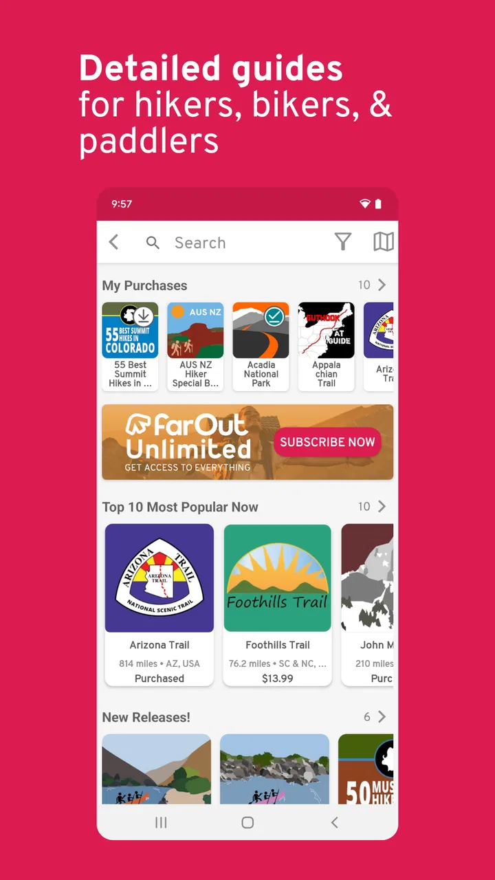
FarOut is an outdoor navigation and guide app designed for hikers, backpackers, and other adventure travelers. It provides detailed route information, downloadable maps, GPS-based positioning, waypoints, trail notes, and user updates. Depending on the guide you select, you can use it to plan a trip, follow a long-distance trail, locate water sources and campsites, and check practical information while traveling outdoors.
02Does FarOut work without an internet connection?
Yes, FarOut is designed to remain useful in areas with limited or no mobile coverage, but you need to prepare before leaving. Download the relevant guide and map data while connected to Wi-Fi or mobile internet. Once downloaded, GPS positioning can generally continue offline. However, features such as live updates, syncing, new comments, and some online content may require an active connection.
03Is FarOut free to download and use?
The app may be available to download at no initial cost, but many of its trail guides or destination packages are sold separately through in-app purchases. The exact price depends on the route or region you choose. Before purchasing, review the guide description and included features carefully, since downloading the app itself does not necessarily provide access to every map, trail, or navigation resource.
04How accurate and useful are FarOut’s maps and trail information?
FarOut is particularly useful because its guides combine mapped routes with practical points of interest and information contributed or updated by the outdoor community. Accuracy can be very good on established trails, but conditions in the real world change. Water availability, closures, damaged bridges, campsite conditions, and route markings may differ from the latest listing, so always verify important details locally and carry suitable backup navigation tools.
05Is FarOut suitable for beginners, and what should I know before relying on it?
FarOut can be approachable for beginners because its waypoints, route lines, elevation information, and comments make unfamiliar trails easier to understand. Nevertheless, it should support—not replace—basic outdoor preparation. Users should learn how to read a map, check weather and official trail notices, carry enough food and water, and bring a backup power source. GPS navigation also does not guarantee safety or rescue in an emergency.
Pros
- Offline maps and guide content are useful when traveling without reliable mobile data.
- Detailed route information helps hikers plan distances
- elevation
- and resupply points.
- User comments can provide timely updates about water sources
- closures
- and trail conditions.
- GPS positioning makes it easier to follow a route and check progress in remote areas.
- The app supports planning for multiple long-distance trails in one place.
Cons
- Full access to many guides and features may require a paid subscription.
- Coverage is focused on supported trails
- limiting its usefulness outside those routes.
- Some trail information depends on user updates and may become outdated.
- Downloading maps and guide data can take considerable storage space.
- Battery usage may increase when GPS tracking runs continuously.

FarOut
Gallery